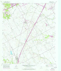
1957 Map of Lorena
USGS Topo · Published 1977About this map
Lorena and Hewitt anchor this central Texas landscape during a period of significant post-war expansion south of Waco. The map documents a territory defined by its drainage systems and rail lines, with the Missouri Kansas Texas and St Louis Southwestern railroads cutting through the prairie. Purple tinting indicates the northward creep of urban development from Robinson and Woodway, as residential areas began to push into former agricultural land.
Find a feature on this map
28 named features on this map. Tap any name to fly to it.
Don’t see what you’re looking for? This feature index may not catch every label — zoom into the map to look around manually.
Map Details
Editions of this 1957 Lorena Map
5 editions found

Other maps of this area

1892 · Temple
USGS Topo · 1:125,000

1892 · Waco
USGS Topo · 1:125,000

1920 · Waco
USGS Topo · 1:125,000

1924 · Waco 4-c
USGS Topo · 1:48,000

1924 · Waco 3-d
USGS Topo · 1:48,000

1931 · Valley Mills
USGS Topo · 1:62,500

1931 · Elm Mott
USGS Topo · 1:62,500

1931 · Mc Gregor
USGS Topo · 1:62,500

1954 · Waco
USGS Topo · 1:250,000

1955 · Waco
USGS Topo · 1:250,000