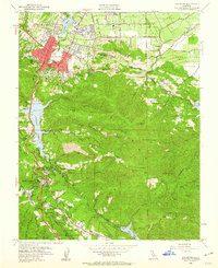
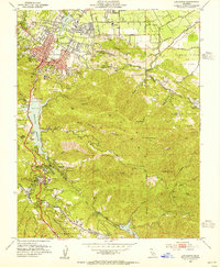
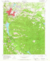
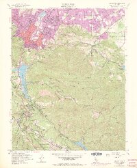
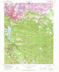
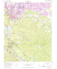
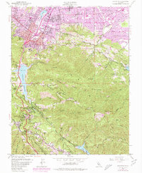
1953 Map of Los Gatos
USGS Topo · Published 1960About this map
Los Gatos sits at the foot of the Santa Cruz Mts, where urban development begins to climb into the forested canyons. This mid-century survey captures the region as residential expansion moves south of Daves Ave and Blossom Hill Road, yet the landscape remains defined by significant water infrastructure and industrial history. The presence of Lexington Reservoir and Vasona Reservoir highlights the critical role of water management for the growing Santa Clara Valley.
Find a feature on this map
68 named features on this map. Tap any name to fly to it.
Don’t see what you’re looking for? This feature index may not catch every label — zoom into the map to look around manually.
Map Details
Editions of this 1953 Los Gatos Map
8 editions found

Other maps of this area

1889 · San Jose
USGS Topo · 1:62,500

1897 · San Jose
USGS Topo · 1:62,500

1897 · Palo Alto
USGS Topo · 1:62,500

1899 · San Jose
USGS Topo · 1:62,500

1899 · Palo Alto
USGS Topo · 1:62,500

1902 · Santa Cruz
USGS Topo · 1:125,000

1916 · New Almaden
USGS Topo · 1:48,000

1919 · New Almaden
USGS Topo · 1:62,500

1940 · Los Gatos
USGS Topo · 1:62,500

1941 · Palo Alto
USGS Topo · 1:62,500