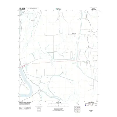
2012 Map of Lottie
USGS Topo · Published 2012About this map
The Atchafalaya River defines the western edge of this landscape, a region where dense bayou networks meet Louisiana’s energy infrastructure. The settlement of Lottie sits at the intersection of local routes like Old State Hwy 190 and Maple St, serving as a focal point near the Cottonwood Cem. To the south, the community of Sherburne is positioned along the banks of the Alabama-Bayou, reflecting a settlement pattern deeply tied to the shifting waterways of the basin.
Find a feature on this map
42 named features on this map. Tap any name to fly to it.
Don’t see what you’re looking for? This feature index may not catch every label — zoom into the map to look around manually.
Map Details
Editions of this 2012 Lottie Map
This is the sole edition of this map. No revisions or reprints were ever made.
Other maps of this area

1935 · Osca Bayou
USGS Topo · 1:62,500

1939 · Fordoche
USGS Topo · 1:62,500

1940 · Arnaudville
USGS Topo · 1:62,500

1953 · Maringouin
USGS Topo · 1:24,000

1954 · Fordoche
USGS Topo · 1:24,000

1954 · Baton Rouge
USGS Topo · 1:250,000

1955 · Osca Bayou
USGS Topo · 1:62,500

1955 · Fordoche
USGS Topo · 1:62,500

1956 · Baton Rouge
USGS Topo · 1:250,000
1959 · Osca Bayou
USGS Topo · 1:62,500