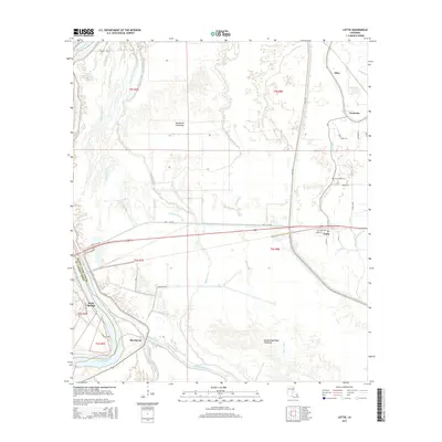
2015 Map of Lottie
USGS Topo · Published 2015About this map
Krotz Springs sits on the western bank of the Atchafalaya River, serving as a critical crossing point between St. Landry Parish and Pointe Coupee Parish. The landscape is dominated by the intricate hydrology of the Atchafalaya Basin, featuring the Morganza Floodway and the Atchafalaya Basin Floodway. These engineering projects dictate the settlement patterns of the region, pushing towns like Lottie, Fordoche, and Aline to the higher ground east of the main spillways.
Find a feature on this map
44 named features on this map. Tap any name to fly to it.
Don’t see what you’re looking for? This feature index may not catch every label — zoom into the map to look around manually.
Map Details
Editions of this 2015 Lottie Map
This is the sole edition of this map. No revisions or reprints were ever made.
Other maps of this area

1935 · Osca Bayou
USGS Topo · 1:62,500

1939 · Fordoche
USGS Topo · 1:62,500

1940 · Arnaudville
USGS Topo · 1:62,500

1953 · Maringouin
USGS Topo · 1:24,000

1954 · Fordoche
USGS Topo · 1:24,000

1954 · Baton Rouge
USGS Topo · 1:250,000

1955 · Osca Bayou
USGS Topo · 1:62,500

1955 · Fordoche
USGS Topo · 1:62,500

1956 · Baton Rouge
USGS Topo · 1:250,000
1959 · Osca Bayou
USGS Topo · 1:62,500