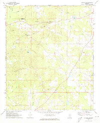
1972 Map of Louisville SW
USGS Topo · Published 1973About this map
The boundary between Choctaw Co and Winston Co runs through this landscape of creek bottoms and rural congregations as it appeared in the early 1970s. This territory is defined by its numerous spiritual and social hubs, including the Ford Community Center and several churches that anchor the local identity, such as Welcome Chapel, Whitehall Ch, and Pleasant Hill Ch. The mapping of fence and field lines from aerial photography provides a window into the land use patterns of the era, showing how small-scale agriculture integrated with the natural drainage of Lobutcha Creek and Noxapater Creek. For those researching local families, the presence of various Sandpit Cem sites and the Steed Cem offers precise locations for ancestral study within the rural tracts south of Louisville.
Find a feature on this map
28 named features on this map. Tap any name to fly to it.
Don’t see what you’re looking for? This feature index may not catch every label — zoom into the map to look around manually.
Map Details
Editions of this 1972 Louisville SW Map
2 editions found
Other maps of this area

1953 · Meridian
USGS Topo · 1:250,000

1953 · West Point
USGS Topo · 1:250,000

1957 · Meridian
USGS Topo · 1:250,000

1958 · West Point
USGS Topo · 1:250,000

1962 · Edinburg
USGS Topo · 1:62,500

1963 · West Point
USGS Topo · 1:250,000

1965 · Meridian
USGS Topo · 1:250,000

1972 · Louisville North
USGS Topo · 1:24,000

1972 · McCool
USGS Topo · 1:24,000

1972 · Highpoint
USGS Topo · 1:24,000