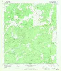
1967 Map of Loyal Valley
USGS Topo · Published 1969About this map
Loyal Valley and the small settlement of Hilda anchor this West Texas landscape during the late 1960s. The area is characterized by a network of seasonal watercourses like Beaver Creek and Threadgill Creek that carve through the hills of the Llano Uplift. Family history and local heritage are marked by several burial sites, including the Ellerbracht Cem and Kothe Cem, alongside a rural Church near Hilda. The terrain is dominated by significant elevations such as Loyal Mountain, Turkey Hill, and Meusebach Mountain, reflecting the geological character of Mason County. Infrastructure is represented by the path of Highway 87 and utility pipelines crossing the southern portion of the quadrangle, while several Gravel Pits indicate the local extractive activity of the era.
Find a feature on this map
38 named features on this map. Tap any name to fly to it.
Don’t see what you’re looking for? This feature index may not catch every label — zoom into the map to look around manually.
Map Details
Editions of this 1967 Loyal Valley Map
2 editions found
Other maps of this area

1887 · Llano
USGS Topo · 1:125,000

1887 · Mason
USGS Topo · 1:125,000

1894 · Mason
USGS Topo · 1:125,000

1894 · Fredericksburg
USGS Topo · 1:125,000

1894 · Kerrville
USGS Topo · 1:125,000

1894 · Llano
USGS Topo · 1:125,000

1904 · Llano
USGS Topo · 1:125,000

1909 · Llano
USGS Topo · 1:125,000

1918 · Llano
USGS Topo · 1:125,000

1954 · Llano
USGS Topo · 1:250,000