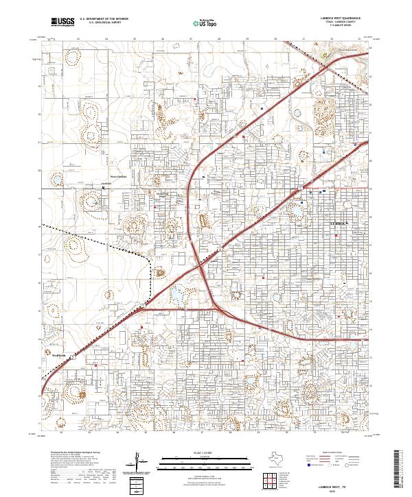
2022 Map of Lubbock West
USGS Topo · Published 2022About this map
Lubbock and the growing satellite communities of the South Plains are captured in this recent survey, showing the westward expansion of the city toward Wolfforth. The landscape is characterized by a dense residential street grid and specialized campuses, including Lubbock Christian University and the Covenant Health School of Radiology. In the northwest, the small settlements of West Carlisle and Carlisle remain distinct from the primary urban sprawl, centered near the Carlisle Cem. The natural topography of the High Plains is marked by Yellow House Draw, which cuts through the northeastern corner of the quadrangle. Transportation corridors like Brownfield Ad and Santa Fe Dr anchor the commercial and industrial growth through Doud, while Resthaven Cem provides a large established landmark near the heart of the developed suburban sectors.
Find a feature on this map
17 named features on this map. Tap any name to fly to it.
Don’t see what you’re looking for? This feature index may not catch every label — zoom into the map to look around manually.
Map Details
Editions of this 2022 Lubbock West Map
This is the sole edition of this map. No revisions or reprints were ever made.
Other maps of this area

1954 · Lubbock
USGS Topo · 1:250,000

1954 · Brownfield
USGS Topo · 1:250,000

1956 · Shallowater
USGS Topo · 1:24,000

1956 · New Deal
USGS Topo · 1:24,000

1957 · Lubbock East
USGS Topo · 1:24,000

1957 · New Home
USGS Topo · 1:62,500

1957 · Lubbock West
USGS Topo · 1:24,000

1957 · Lubbock
USGS Topo · 1:62,500

1957 · Meadow
USGS Topo · 1:62,500

1957 · Wolfforth
USGS Topo · 1:62,500