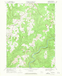
1967 Map of Lucinda
USGS Topo · Published 1971About this map
The Clarion River carves a deep, winding course through the southeastern reaches of this landscape, marking the transition between the agricultural uplands and the timbered slopes of Cook Forest State Park. The 1960s economy of the region is clearly visible through the extensive network of gas wells and numerous strip mines that pockmark the terrain near Snydersburg and Scotch Hill. This industrial footprint exists alongside older historical layers, most notably the Iron Furnace (Ruins) located near the settlement of Helen Furnace, a tangible link to the area's 19th-century iron heritage.
Find a feature on this map
44 named features on this map. Tap any name to fly to it.
Don’t see what you’re looking for? This feature index may not catch every label — zoom into the map to look around manually.
Map Details
Editions of this 1967 Lucinda Map
4 editions found
Other maps of this area

1906 · Clarion
USGS Topo · 1:62,500

1907 · Clarion
USGS Topo · 1:62,500

1918 · Loleta
USGS Topo · 1:62,500

1922 · Tionesta
USGS Topo · 1:62,500

1924 · Tionesta
USGS Topo · 1:62,500

1924 · Brookville
USGS Topo · 1:62,500

1926 · Brookville
USGS Topo · 1:62,500

1936 · Marienville
USGS Topo · 1:48,000

1941 · Marienville
USGS Topo · 1:62,500

1944 · Brookville
USGS Topo · 1:62,500
Featured Places
- Millcreek Township, PA
- Lucinda, Knox Township
- Highland Township, PA
- Farmington Township, PA
- Paint Township, PA