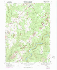
1967 Map of Lucinda
USGS Topo · Published 1984About this map
The Clarion River winds through the southern reaches of this landscape, flanked by the deep ravines of Cattikan Run and McGarvey Run. In the late 1960s, the region was defined by a mix of heavy resource extraction and quiet hilltop settlements. Extensive strip mines dot the terrain around Snydersburg and Lucinda, contrasting with the preserved timberlands of Cook Forest State Park in the northeast.
Find a feature on this map
48 named features on this map. Tap any name to fly to it.
Don’t see what you’re looking for? This feature index may not catch every label — zoom into the map to look around manually.
Map Details
Editions of this 1967 Lucinda Map
4 editions found
Other maps of this area

1906 · Clarion
USGS Topo · 1:62,500

1907 · Clarion
USGS Topo · 1:62,500

1918 · Loleta
USGS Topo · 1:62,500

1922 · Tionesta
USGS Topo · 1:62,500

1924 · Tionesta
USGS Topo · 1:62,500

1924 · Brookville
USGS Topo · 1:62,500

1926 · Brookville
USGS Topo · 1:62,500

1936 · Marienville
USGS Topo · 1:48,000

1941 · Marienville
USGS Topo · 1:62,500

1944 · Brookville
USGS Topo · 1:62,500