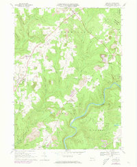
1967 Map of Lucinda
USGS Topo · Published 1973About this map
The Clarion River carves a deep valley through the southern portion of this region, providing a natural boundary for the townships of Highland, Paint, and Millcreek. Industry and geography are closely intertwined here, with numerous strip mines dotting the plateaus above the river and the Baltimore and Ohio line threading north through Lucinda and Snydersburg. A notable remnant of earlier 19th-century industry is the Iron Furnace (Ruins) located near Helen Furnace, signaling the area's history of iron production before the dominance of contemporary gas and coal extraction.
Find a feature on this map
47 named features on this map. Tap any name to fly to it.
Don’t see what you’re looking for? This feature index may not catch every label — zoom into the map to look around manually.
Map Details
Editions of this 1967 Lucinda Map
4 editions found
Other maps of this area

1906 · Clarion
USGS Topo · 1:62,500

1907 · Clarion
USGS Topo · 1:62,500

1918 · Loleta
USGS Topo · 1:62,500

1922 · Tionesta
USGS Topo · 1:62,500

1924 · Tionesta
USGS Topo · 1:62,500

1924 · Brookville
USGS Topo · 1:62,500

1926 · Brookville
USGS Topo · 1:62,500

1936 · Marienville
USGS Topo · 1:48,000

1941 · Marienville
USGS Topo · 1:62,500

1944 · Brookville
USGS Topo · 1:62,500