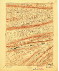
1893 Map of Lykens
USGS Topo · Published 1908About this map
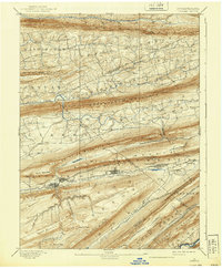
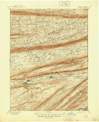
The anthracite-rich corridor of the Wiconisco Creek valley dominates this late 19th-century survey, revealing a landscape defined by industrial development and sharp ridges. Large mining communities like Lykens, Williamstown, and Tower City are established along the southern flanks of Short Mountain and Bear Mountain, where the Summit Branch Railroad provides the critical link to market. The map illustrates a stark contrast between these concentrated coal towns and the agricultural valleys to the north, such as Valley View and Hegins, where smaller crossroads like Rough and Ready and Klingerstown serve local farming populations.
Find a feature on this map
85 named features on this map. Tap any name to fly to it.
Don’t see what you’re looking for? This feature index may not catch every label — zoom into the map to look around manually.
Map Details
Editions of this 1893 Lykens Map
7 editions found
Other maps of this area

1889 · Catawissa
USGS Topo · 1:62,500

1891 · Lebanon
USGS Topo · 1:62,500

1892 · Catawissa
USGS Topo · 1:62,500

1892 · Lykens
USGS Topo · 1:62,500

1892 · Hummelstown
USGS Topo · 1:62,500

1892 · Shamokin
USGS Topo · 1:62,500

1892 · Harrisburg
USGS Topo · 1:62,500

1892 · Pine Grove
USGS Topo · 1:62,500

1893 · Sunbury
USGS Topo · 1:62,500

1893 · Lykens
USGS Topo · 1:62,500