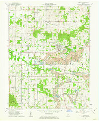
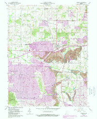
1960 Map of Lynnville
USGS Topo · Published 1976About this map
The town of Lynnville sits at the center of this 1960 survey, serving as a hub for the surrounding rural townships of Barton, Monroe, and Hart. The landscape is defined by the heavy footprint of the regional extraction industry, with massive Strip Mines and the specific Lynnville Mine altering the terrain south and east of the town center. The New York Central railroad cuts a diagonal path through the area, facilitating the movement of coal and agricultural goods from the nearby Quarry and Grain Storage Bins.
Find a feature on this map
56 named features on this map. Tap any name to fly to it.
Don’t see what you’re looking for? This feature index may not catch every label — zoom into the map to look around manually.
Map Details
Editions of this 1960 Lynnville Map
5 editions found
Other maps of this area

1900 · De Gonia Springs
USGS Topo · 1:62,500

1902 · Ditney
USGS Topo · 1:125,000

1902 · Degonia Springs
USGS Topo · 1:62,500

1902 · Boonville
USGS Topo · 1:62,500

1903 · Velpen
USGS Topo · 1:62,500

1903 · Petersburg
USGS Topo · 1:62,500

1956 · Vincennes
USGS Topo · 1:250,000

1957 · Vincennes
USGS Topo · 1:250,000

1958 · Vincennes
USGS Topo · 1:250,000
1960 · De Gonia Springs
USGS Topo · 1:24,000