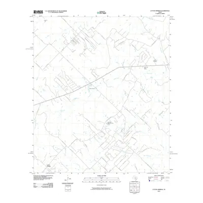
2010 Map of Lytton Springs
USGS Topo · Published 2010About this map
The settlement of Lytton Springs serves as the focal point for this 2010 study of the Central Texas landscape, where modern rural development meets historical transportation corridors. The network of roads, including the notable Old San Antonio Rd, illustrates the evolution of local travel. Water management is a defining characteristic of the terrain, with features like Trigg Lake Dam and the curiously named Texas No Name Number 52 Dam regulating the flow of Cedar Creek and Alum Creek. Genealogy and local history researchers will find the locations of Lower Cedar Creek Cemetery and Upper Cedar Creek Cemetery particularly useful for identifying family sites. The presence of the Elroy Oil Field in the northwest corner highlights the ongoing significance of the region's mineral extraction industry alongside its residential growth.
Find a feature on this map
65 named features on this map. Tap any name to fly to it.
Don’t see what you’re looking for? This feature index may not catch every label — zoom into the map to look around manually.
Map Details
Editions of this 2010 Lytton Springs Map
This is the sole edition of this map. No revisions or reprints were ever made.
Other maps of this area

1885 · Bastrop
USGS Topo · 1:125,000

1893 · Bastrop
USGS Topo · 1:125,000

1896 · Austin
USGS Topo · 1:125,000

1897 · Austin
USGS Topo · 1:125,000

1901 · Flatonia
USGS Topo · 1:125,000

1904 · Bastrop
USGS Topo · 1:125,000

1910 · Austin
USGS Topo · 1:125,000

1911 · San Marcos
USGS Topo · 1:125,000

1919 · San Marcos
USGS Topo · 1:125,000

1930 · Lockhart
USGS Topo · 1:62,500