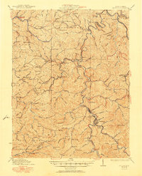
1931 Map of Madison
USGS Topo · Published 1951About this map
The Little Coal River and its major forks define the economic and social geography of this region during the early 20th century. Following the 1929 culture revision, the map shows the extensive Chesapeake and Ohio rail infrastructure necessary for timber and coal transport, including significant engineering feats like the Pinnacle Tunnel and Blue Tom Tunnel. The county seat of Madison serves as a central hub, flanked by Danville and East Madison, while numerous smaller communities like Uneeda, Alkol, and Griffithsville are scattered along the narrow valley floors.
Find a feature on this map
122 named features on this map. Tap any name to fly to it.
Don’t see what you’re looking for? This feature index may not catch every label — zoom into the map to look around manually.
Map Details
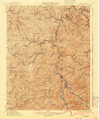
Editions of this 1931 Madison Map
3 editions found

Other maps of this area

1887 · Warfield
USGS Topo · 1:125,000

1891 · Oceana
USGS Topo · 1:125,000

1891 · Warfield
USGS Topo · 1:125,000

1892 · Huntington
USGS Topo · 1:125,000

1893 · Oceana
USGS Topo · 1:125,000

1898 · Huntington
USGS Topo · 1:125,000

1898 · Oceana
USGS Topo · 1:125,000

1899 · Charleston
USGS Topo · 1:125,000

1902 · Milton
USGS Topo · 1:62,500

1902 · Midkiff
USGS Topo · 1:62,500