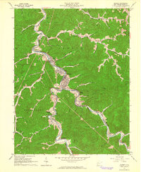
1962 Map of Madison
USGS Topo · Published 1964About this map
The Little Coal River serves as the central artery for this part of Boone County, winding through the narrow valleys that define the local geography. Along its banks, the established settlements of Danville and Madison form a tight-knit residential and commercial corridor, mirrored further south by South Madison. The influence of the Chesapeake And Ohio railroad is evident, following the water's edge to serve the numerous Gas Wells and coal interests spread across the Scott and Washington districts.
Find a feature on this map
86 named features on this map. Tap any name to fly to it.
Don’t see what you’re looking for? This feature index may not catch every label — zoom into the map to look around manually.
Map Details
Editions of this 1962 Madison Map
4 editions found
Other maps of this area

1891 · Oceana
USGS Topo · 1:125,000

1893 · Oceana
USGS Topo · 1:125,000

1898 · Oceana
USGS Topo · 1:125,000

1899 · Charleston
USGS Topo · 1:125,000

1909 · Peytona
USGS Topo · 1:48,000

1910 · Bald Knob
USGS Topo · 1:48,000

1911 · Peytona
USGS Topo · 1:62,500

1911 · Madison
USGS Topo · 1:62,500

1912 · Bald Knob
USGS Topo · 1:62,500

1913 · Logan
USGS Topo · 1:62,500