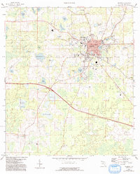
1959 Map of Madison
USGS Topo · Published 1993About this map
Madison serves as the regional hub in this mid-century survey, showcasing a landscape where civic institutions and natural wetlands define the North Florida interior. The town core is anchored by the Courthouse and Hospital, with the campus of North Florida Junior College and the County Training Sch indicating its role as an educational center for the county. The arrival of the Georgia and Florida RR and the proximity of the Madison Country Club suggest a town balanced between industry and established social life.
Find a feature on this map
48 named features on this map. Tap any name to fly to it.
Don’t see what you’re looking for? This feature index may not catch every label — zoom into the map to look around manually.
Map Details
Editions of this 1959 Madison Map
2 editions found
Other maps of this area

1954 · Greenville NE
USGS Topo · 1:24,000

1954 · Valdosta
USGS Topo · 1:250,000

1955 · Greenville SE
USGS Topo · 1:24,000

1958 · Valdosta
USGS Topo · 1:250,000

1958 · Madison SW
USGS Topo · 1:24,000

1958 · Madison SE
USGS Topo · 1:24,000

1958 · Lee
USGS Topo · 1:24,000

1959 · Valdosta
USGS Topo · 1:250,000

1959 · Madison
USGS Topo · 1:24,000

1960 · Cherry Lake
USGS Topo · 1:24,000