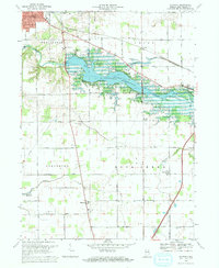
1969 Map of Majenica
USGS Topo · Published 1971About this map
The Wabash River valley underwent significant transformation by the late 1960s with the development of the Huntington Reservoir, which dominates the northern half of this landscape. The reservoir, with its Huntington State Recreation Area, sits just south of Huntington and the Erie-Lackawanna rail line. To the south, the terrain transitions into a grid of agricultural lands across Lancaster and Rock Creek townships, where small rural hubs like Majenica and Rock Creek Center persist.
Find a feature on this map
48 named features on this map. Tap any name to fly to it.
Don’t see what you’re looking for? This feature index may not catch every label — zoom into the map to look around manually.
Map Details
Editions of this 1969 Majenica Map
3 editions found
Other maps of this area

1950 · Andrews
USGS Topo · 1:24,000

1950 · Warren
USGS Topo · 1:24,000

1950 · Mount Etna
USGS Topo · 1:24,000

1951 · Mount Etna
USGS Topo · 1:24,000

1951 · Andrews
USGS Topo · 1:24,000

1952 · Warren
USGS Topo · 1:24,000

1952 · Majenica
USGS Topo · 1:24,000

1953 · Muncie
USGS Topo · 1:250,000

1955 · Markle
USGS Topo · 1:24,000

1955 · Bippus
USGS Topo · 1:24,000