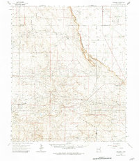
1963 Map of Maljamar
USGS Topo · Published 1981About this map
The vast industrial footprint of the Permian Basin dominates this landscape during the early 1960s, defined by a dense network of pipelines and storage tanks serving numerous extraction zones. Prominent fields such as the Grayburg Jackson Oil Field and the Robinson Oil Field underscore the economic engine of this region. The terrain is sharply divided by the Mescalero Ridge (The Caprock), a dramatic escarpment that separates the shifting Mescalero Sands to the west from the lower Querecho Plains to the east.
Find a feature on this map
29 named features on this map. Tap any name to fly to it.
Don’t see what you’re looking for? This feature index may not catch every label — zoom into the map to look around manually.
Map Details
Editions of this 1963 Maljamar Map
2 editions found

Other maps of this area

1942 · Clayton Basin
USGS Topo · 1:62,500

1943 · Clayton Basin
USGS Topo · 1:62,500

1943 · Oil City
USGS Topo · 1:62,500

1951 · King Camp
USGS Topo · 1:24,000

1953 · Basin Well
USGS Topo · 1:24,000

1954 · Carlsbad
USGS Topo · 1:250,000

1954 · Hobbs
USGS Topo · 1:250,000

1954 · Brownfield
USGS Topo · 1:250,000

1955 · Red Lake SE
USGS Topo · 1:24,000

1955 · Roswell
USGS Topo · 1:250,000