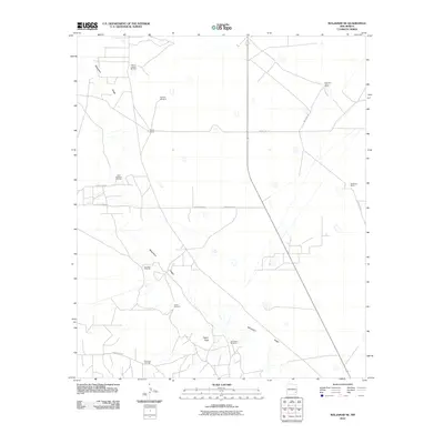
2010 Map of Maljamar NE
USGS Topo · Published 2010About this map
Mescalero Ridge cuts through this high desert landscape, defining the transition between the plains and the more varied terrain of the Caprock. This area of Lea County is characterized by a legacy of ranching and energy extraction, as seen in the presence of Bond Ranch, Holeman-Taylor Ranch, and Anderson Ranch. The geography is dotted with evidence of the local water and energy infrastructure, including the Four Bac Windmill and the South Caprock Oil Field. The network of secondary roads, such as County Rd-121 and Willbank Rd, provides access across a region where prominent natural landmarks like Taylor Peak offer orientation amidst the extensive West Anderson Oil Field and Robinson Oil Field.
Find a feature on this map
17 named features on this map. Tap any name to fly to it.
Don’t see what you’re looking for? This feature index may not catch every label — zoom into the map to look around manually.
Map Details
Editions of this 2010 Maljamar NE Map
This is the sole edition of this map. No revisions or reprints were ever made.
Other maps of this area

1954 · Hobbs
USGS Topo · 1:250,000

1954 · Brownfield
USGS Topo · 1:250,000

1958 · Brownfield
USGS Topo · 1:250,000

1958 · Hobbs
USGS Topo · 1:250,000

1962 · Brownfield
USGS Topo · 1:250,000

1962 · Buckeye
USGS Topo · 1:62,500

1963 · Maljamar
USGS Topo · 1:62,500
1973 · Cedar Point
USGS Topo · 1:24,000

1973 · Dean Ranch
USGS Topo · 1:24,000
1973 · Cedar Point SE
USGS Topo · 1:24,000