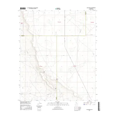
2017 Map of Maljamar NE
USGS Topo · Published 2017About this map
Mescalero Ridge dominates this high desert landscape on the boundary of Lea, Eddy, and Chaves Counties. This escarpment creates a sharp topographic divide, with Taylor Peak standing as a prominent point along the rim and Taylor Draw cutting through the slopes below. The plateau above the ridge is marked by a sparse network of ranch and service roads such as Tower Rd, Viola Rd, and Alice Rd, which connect remote sections of the Llano Estacado.
Find a feature on this map
22 named features on this map. Tap any name to fly to it.
Don’t see what you’re looking for? This feature index may not catch every label — zoom into the map to look around manually.
Map Details
Editions of this 2017 Maljamar NE Map
This is the sole edition of this map. No revisions or reprints were ever made.
Other maps of this area

1954 · Hobbs
USGS Topo · 1:250,000

1954 · Brownfield
USGS Topo · 1:250,000

1958 · Brownfield
USGS Topo · 1:250,000

1958 · Hobbs
USGS Topo · 1:250,000

1962 · Brownfield
USGS Topo · 1:250,000

1962 · Buckeye
USGS Topo · 1:62,500

1963 · Maljamar
USGS Topo · 1:62,500
1973 · Cedar Point
USGS Topo · 1:24,000

1973 · Dean Ranch
USGS Topo · 1:24,000
1973 · Cedar Point SE
USGS Topo · 1:24,000