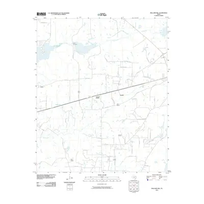
2010 Map of Mallard Hill
USGS Topo · Published 2010About this map
Crescent Heights and the small settlement of Dauphin anchor this central Henderson County landscape, situated along the drainage of Walnut Creek and Caney Creek. The area reflects a mix of rural residential development and persistent industrial activity, evidenced by Mine Number Five and the Tri-Cities Gas Field near the southern boundary. Local history is preserved through several family and community burial grounds, including Malakoff Cemetery, Walnut Creek Cemetery, and Goodgame Cemetery. Transport and utility infrastructure is prominent, featuring a network of county roads like Walnut Creek Rd and Kinsey Holman Rd. The northern section is defined by water management at the Forest Grove Dam, creating a significant reservoir, while private aviation is noted at the Circle R Ranch Airport to the south. This map provides a detailed view of the rural-industrial interface near Athens at the end of the first decade of the 21st century.
Find a feature on this map
61 named features on this map. Tap any name to fly to it.
Don’t see what you’re looking for? This feature index may not catch every label — zoom into the map to look around manually.
Map Details
Editions of this 2010 Mallard Hill Map
This is the sole edition of this map. No revisions or reprints were ever made.
Other maps of this area

1920 · Kemp
USGS Topo · 1:62,500

1948 · Martins Mill
USGS Topo · 1:62,500

1949 · Martins Mill
USGS Topo · 1:62,500

1949 · Athens
USGS Topo · 1:62,500

1950 · Athens
USGS Topo · 1:62,500

1954 · Dallas
USGS Topo · 1:250,000

1956 · Tyler
USGS Topo · 1:250,000

1957 · Kemp
USGS Topo · 1:62,500

1958 · Dallas
USGS Topo · 1:250,000

1960 · Mabank
USGS Topo · 1:24,000