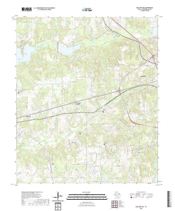
2022 Map of Mallard Hill
USGS Topo · Published 2022About this map
Malakoff and the western outskirts of Athens define the landscape of Henderson County in this modern record of the East Texas post-oak savannah. The terrain is characterized by a dense network of country roads and creek drainages that feed into the massive Cedar Creek Reservoir and Dodd Lake. Settlement patterns are evident in the cluster of community landmarks such as Crescent Heights and several family or church-affiliated burial grounds, including Walnut Creek Cem and Smith Cem. Local infrastructure supports both agricultural and private aviation interests, anchored by the Circle R Ranch Airport south of the primary east-west corridors. The map reveals how the modern road system, including E Royall Blvd and numerous county routes, has integrated older rural homesteads with the growing municipal footprints of the region.
Find a feature on this map
84 named features on this map. Tap any name to fly to it.
Don’t see what you’re looking for? This feature index may not catch every label — zoom into the map to look around manually.
Map Details
Editions of this 2022 Mallard Hill Map
This is the sole edition of this map. No revisions or reprints were ever made.
Other maps of this area

1920 · Kemp
USGS Topo · 1:62,500

1948 · Martins Mill
USGS Topo · 1:62,500

1949 · Martins Mill
USGS Topo · 1:62,500

1949 · Athens
USGS Topo · 1:62,500

1950 · Athens
USGS Topo · 1:62,500

1954 · Dallas
USGS Topo · 1:250,000

1956 · Tyler
USGS Topo · 1:250,000

1957 · Kemp
USGS Topo · 1:62,500

1958 · Dallas
USGS Topo · 1:250,000

1960 · Mabank
USGS Topo · 1:24,000