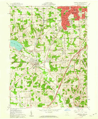
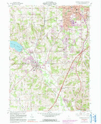
1961 Map of Mansfield South
USGS Topo · Published 1962About this map
Mansfield expands south toward the Clear Fork Reservoir in the early 1960s, a period of notable suburban and institutional growth for Richland County. The city's southern residential development is anchored by schools like Woodville Sch and the Johnny Appleseed Jr High Sch, while the massive Mansfield Cemetery dominates the northeastern section of the quadrangle. Outside the urban core, the landscape retains its agricultural and industrial character, defined by the Baltimore and Ohio RR corridor and the winding Clear Fork Mohican River.
Find a feature on this map
83 named features on this map. Tap any name to fly to it.
Don’t see what you’re looking for? This feature index may not catch every label — zoom into the map to look around manually.
Map Details
Editions of this 1961 Mansfield South Map
5 editions found
Other maps of this area

1908 · Ashland
USGS Topo · 1:62,500

1912 · Perrysville
USGS Topo · 1:62,500

1915 · Crestline
USGS Topo · 1:62,500

1915 · Perrysville
USGS Topo · 1:62,500

1915 · Shauck
USGS Topo · 1:62,500

1943 · Shauck
USGS Topo · 1:62,500

1943 · Crestline
USGS Topo · 1:62,500

1944 · Perrysville
USGS Topo · 1:62,500

1950 · Marion
USGS Topo · 1:250,000

1960 · Pavonia
USGS Topo · 1:24,000