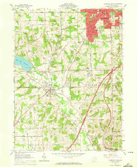
1961 Map of Mansfield South
USGS Topo · Published 1972About this map
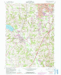
The southern outskirts of Mansfield give way to the wooded ridges and agricultural valleys of Richland County during the early 1960s. The landscape is defined by the recently established Clear Fork Reservoir, which stands as a prominent topographical feature near the western edge. This period shows significant expansion in Lexington and the growth of residential developments like Hanley Village, illustrating the post-war suburbanization of the region as it pushed outward from the urban center.
Find a feature on this map
59 named features on this map. Tap any name to fly to it.
Don’t see what you’re looking for? This feature index may not catch every label — zoom into the map to look around manually.
Map Details
Editions of this 1961 Mansfield South Map
5 editions found
Other maps of this area

1908 · Ashland
USGS Topo · 1:62,500

1912 · Perrysville
USGS Topo · 1:62,500

1915 · Crestline
USGS Topo · 1:62,500

1915 · Perrysville
USGS Topo · 1:62,500

1915 · Shauck
USGS Topo · 1:62,500

1943 · Shauck
USGS Topo · 1:62,500

1943 · Crestline
USGS Topo · 1:62,500

1944 · Perrysville
USGS Topo · 1:62,500

1950 · Marion
USGS Topo · 1:250,000

1960 · Pavonia
USGS Topo · 1:24,000