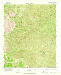
1964 Map of Manzanita Mtn
USGS Topo · Published 1965About this map
Manzanita Mountain and the deep canyons of the Los Padres National Forest define this backcountry survey, field-checked in the mid-1960s. The landscape is marked by a complex drainage system where the North Fork La Brea Creek and South Fork La Brea Creek converge, surrounded by steep terrain such as Buckhorn Ridge and the southern reaches of the Sierra Madre Mts.
Find a feature on this map
38 named features on this map. Tap any name to fly to it.
Don’t see what you’re looking for? This feature index may not catch every label — zoom into the map to look around manually.
Map Details
Editions of this 1964 Manzanita Mtn Map
4 editions found
Other maps of this area

1902 · Santa Ynez
USGS Topo · 1:125,000

1905 · Santa Ynez
USGS Topo · 1:125,000

1905 · Lompoc
USGS Topo · 1:125,000

1912 · McKittrick
USGS Topo · 1:125,000

1937 · Branch Mtn
USGS Topo · 1:48,000

1941 · Caliente Mountain
USGS Topo · 1:62,500

1941 · McPherson Peak
USGS Topo · 1:62,500

1942 · Lompoc
USGS Topo · 1:125,000

1942 · Branch Mountain
USGS Topo · 1:62,500

1942 · Caliente Mtn
USGS Topo · 1:62,500