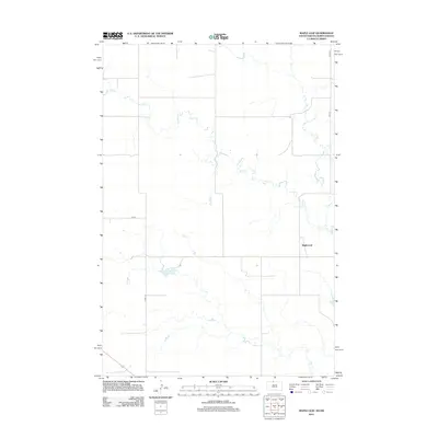
2012 Map of Maple Leaf
USGS Topo · Published 2012About this map
Maple Leaf marks a quiet settlement in Corson County, situated along the undulating drainage of Oak Cr. The landscape here is defined by the sparse, grid-like intersection of rural transit routes such as 24th St and 27th Ave, reflecting the expansive agricultural and ranching patterns of the Northern Plains. Small, unnamed impoundments and the winding path of the creek create distinct topographical breaks in an otherwise open prairie environment. The road network, including Co Rd-13-2 and various other stretches of Co Rd, connects the isolated farmsteads and points of interest that characterize this border region between the Dakotas in the early twenty-first century. This survey documents the area as it appeared before further modern shifts in rural infrastructure.
Find a feature on this map
6 named features on this map. Tap any name to fly to it.
Don’t see what you’re looking for? This feature index may not catch every label — zoom into the map to look around manually.
Map Details
Editions of this 2012 Maple Leaf Map
This is the sole edition of this map. No revisions or reprints were ever made.
Other maps of this area

1953 · McIntosh
USGS Topo · 1:250,000

1954 · Bismarck
USGS Topo · 1:250,000

1956 · Bullhead
USGS Topo · 1:24,000

1958 · Bismarck
USGS Topo · 1:250,000

1958 · McIntosh
USGS Topo · 1:250,000

1966 · McLaughlin
USGS Topo · 1:24,000

1966 · McLaughlin NE
USGS Topo · 1:24,000
1971 · Selfridge SE
USGS Topo · 1:24,000

1971 · Selfridge
USGS Topo · 1:24,000

1971 · Pamplin Hills
USGS Topo · 1:24,000
Featured Places
- McLaughlin, SD
- Fort Yates District, ND
- Porcupine District, ND
- Rock Creek District, SD
- Maple Leaf, McLaughlin