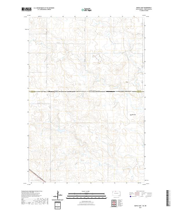
2021 Map of Maple Leaf
USGS Topo · Published 2021About this map
Maple Leaf sits in the heart of this prairie landscape, situated near the headwaters and drainages of Oak Cr. This 2021 topographic survey reveals a quiet, agrarian corner of Corson County where the border between the Dakotas is physically marked by State Line St. The terrain is defined by a network of sectional roads and rural routes, including Co Rd 13-2 and Cr 165, which provide the primary connectivity across these vast township boundaries. The map documents the persistent layout of the Public Land Survey System, with township and range lines such as t23n r26e organizing the remote homesteads and ranches. This record is essential for understanding the modern footprint of these historic northern plains communities, where the proximity to water and the state line continues to shape local life.
Find a feature on this map
19 named features on this map. Tap any name to fly to it.
Don’t see what you’re looking for? This feature index may not catch every label — zoom into the map to look around manually.
Map Details
Editions of this 2021 Maple Leaf Map
This is the sole edition of this map. No revisions or reprints were ever made.
Other maps of this area

1953 · McIntosh
USGS Topo · 1:250,000

1954 · Bismarck
USGS Topo · 1:250,000

1956 · Bullhead
USGS Topo · 1:24,000

1958 · Bismarck
USGS Topo · 1:250,000

1958 · McIntosh
USGS Topo · 1:250,000

1966 · McLaughlin
USGS Topo · 1:24,000

1966 · McLaughlin NE
USGS Topo · 1:24,000
1971 · Selfridge SE
USGS Topo · 1:24,000

1971 · Selfridge
USGS Topo · 1:24,000

1971 · Pamplin Hills
USGS Topo · 1:24,000
Featured Places
- McLaughlin, SD
- Fort Yates District, ND
- Maple Leaf, McLaughlin
- Rock Creek District, SD
- Porcupine District, ND