
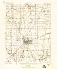
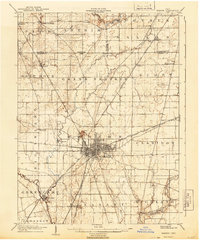
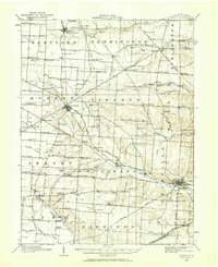
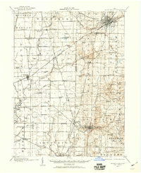
1915 Map of Marengo
USGS Topo · Published 1946About this map
The agricultural heartland of central Ohio is meticulously documented in this survey, showcasing the dense network of rural school districts and small villages that defined the region before modern consolidation. Significant local history is found in the varied named schools, including Swamp Angel School, Goose Heaven School, and the Independence Hall School. The landscape is split between the northern drainage of Big Walnut Creek and the southern flow of Alum Creek, where the County Infirmary sits near Kilbourne.
Find a feature on this map
129 named features on this map. Tap any name to fly to it.
Don’t see what you’re looking for? This feature index may not catch every label — zoom into the map to look around manually.
Map Details
Editions of this 1915 Marengo Map
This is the sole edition of this map. No revisions or reprints were ever made.
Other maps of this area

1901 · Dublin
USGS Topo · 1:62,500

1902 · Westerville
USGS Topo · 1:62,500

1903 · Dublin
USGS Topo · 1:62,500
1903 · Marion
USGS Topo · 1:62,500

1904 · Westerville
USGS Topo · 1:62,500
1905 · Marion
USGS Topo · 1:62,500
1908 · Granville
USGS Topo · 1:62,500

1910 · Granville
USGS Topo · 1:62,500
1913 · Mount Gilead
USGS Topo · 1:62,500

1915 · Shauck
USGS Topo · 1:62,500
Featured Places
- Berkshire, Berkshire Township
- Sunbury, OH
- Cardington, Cardington Township
- Westfield, Westfield Township
- Ashley, Oxford Township