
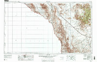
1959 Map of Marfa
USGS Topo · Published 1976About this map
High desert elevations and the serpentine course of the Rio Grande define this Trans-Pecos landscape during the late 1950s and mid-1970s. The Southern Pacific railroad serves as the primary corridor for commerce and travel, connecting the small desert community of Valentine with the ranching hub of Marfa. High above the plains, the Davis Mountains dominate the eastern view, featuring peaks like Mount Livermore and the scientific outpost at McDonald Observatory on Mount Locke.
Find a feature on this map
47 named features on this map. Tap any name to fly to it.
Don’t see what you’re looking for? This feature index may not catch every label — zoom into the map to look around manually.
Map Details
Editions of this 1959 Marfa Map
2 editions found
Other maps of this area

1892 · Chispa
USGS Topo · 1:125,000

1894 · Fort Hancock
USGS Topo · 1:125,000

1894 · Valentine
USGS Topo · 1:125,000

1894 · Fort Davis
USGS Topo · 1:125,000

1895 · Chispa
USGS Topo · 1:125,000

1895 · Marfa
USGS Topo · 1:125,000

1895 · Sierra Blanca
USGS Topo · 1:125,000

1895 · Alpine
USGS Topo · 1:125,000

1896 · Ruidosa
USGS Topo · 1:125,000

1896 · San Carlos
USGS Topo · 1:125,000