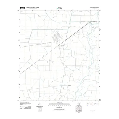
2010 Map of Markham
USGS Topo · Published 2010About this map
Markham serves as the primary residential hub in this coastal prairie landscape of Matagorda County, where the town’s established street grid stands in contrast to the surrounding agricultural and industrial expanse. To the southeast, the small settlement of Buckeye is connected by a network of rural routes including Elmaton-Buckeye Rd and Buckeye Ranch Rd. The eastern edge of the map is defined by the winding course of the Colorado River, which feeds into Lake Le Tulle and is regulated by the Lcra Dam. This 2010 survey illustrates the region's reliance on both aviation and water management, featuring the W D Cornelius Ranch Airport alongside a complex system of drainage and irrigation canals like Wilson Creek that support the local ranching and rice-farming economy.
Find a feature on this map
16 named features on this map. Tap any name to fly to it.
Don’t see what you’re looking for? This feature index may not catch every label — zoom into the map to look around manually.
Map Details
Editions of this 2010 Markham Map
This is the sole edition of this map. No revisions or reprints were ever made.
Other maps of this area

1950 · Houston
USGS Topo · 1:250,000

1951 · Bay City
USGS Topo · 1:250,000

1951 · Danevang
USGS Topo · 1:24,000

1952 · Lane City SE
USGS Topo · 1:24,000

1952 · Blessing SE
USGS Topo · 1:24,000

1952 · Blessing
USGS Topo · 1:24,000

1952 · Bay City
USGS Topo · 1:24,000

1952 · Markham
USGS Topo · 1:24,000

1952 · Van Vleck
USGS Topo · 1:24,000

1952 · Midfield
USGS Topo · 1:24,000