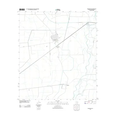
2013 Map of Markham
USGS Topo · Published 2013About this map
Markham serves as the primary settlement on this Matagorda County coastal plain, where the landscape is defined by an intricate network of drainage and irrigation routes such as Wilson Cr. The town's grid is clearly delineated, stretching from Avenue I to Avenue A, reflecting its organized development in the Texas rice-growing belt. South of the main townsite, the small settlement of Buckeye sits near the winding path of the Colorado River, an area characterized by large-scale ranching and agricultural operations.
Find a feature on this map
26 named features on this map. Tap any name to fly to it.
Don’t see what you’re looking for? This feature index may not catch every label — zoom into the map to look around manually.
Map Details
Editions of this 2013 Markham Map
This is the sole edition of this map. No revisions or reprints were ever made.
Other maps of this area

1950 · Houston
USGS Topo · 1:250,000

1951 · Bay City
USGS Topo · 1:250,000

1951 · Danevang
USGS Topo · 1:24,000

1952 · Lane City SE
USGS Topo · 1:24,000

1952 · Blessing SE
USGS Topo · 1:24,000

1952 · Blessing
USGS Topo · 1:24,000

1952 · Bay City
USGS Topo · 1:24,000

1952 · Markham
USGS Topo · 1:24,000

1952 · Van Vleck
USGS Topo · 1:24,000

1952 · Midfield
USGS Topo · 1:24,000