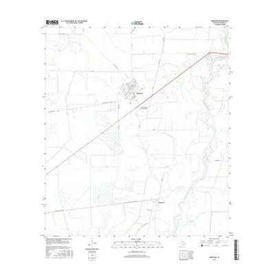
2016 Map of Markham
USGS Topo · Published 2016About this map
The Markham townsite anchors this coastal prairie landscape, its grid of numbered streets like 11th St and 1st St situated just west of the meandering Colorado River. The area’s ranching and industrial character is evident in the inclusion of the W D Cornelius Ranch Airport and specialized thoroughfares like Channel Industry Rd. Water management and natural drainage define the terrain, with Wilson Cr cutting across the central plains and Lake Le Tulle situated near the riverbanks in the southeast. Further south, the settlement of Buckeye marks a transition toward the rural road networks of Elmaton-Buckeye Rd and CR 411 / Buckeye - El Maton Rd, reflecting the interconnected agricultural communities of Matagorda County.
Find a feature on this map
50 named features on this map. Tap any name to fly to it.
Don’t see what you’re looking for? This feature index may not catch every label — zoom into the map to look around manually.
Map Details
Editions of this 2016 Markham Map
This is the sole edition of this map. No revisions or reprints were ever made.
Other maps of this area

1950 · Houston
USGS Topo · 1:250,000

1951 · Bay City
USGS Topo · 1:250,000

1951 · Danevang
USGS Topo · 1:24,000

1952 · Lane City SE
USGS Topo · 1:24,000

1952 · Blessing SE
USGS Topo · 1:24,000

1952 · Blessing
USGS Topo · 1:24,000

1952 · Bay City
USGS Topo · 1:24,000

1952 · Markham
USGS Topo · 1:24,000

1952 · Van Vleck
USGS Topo · 1:24,000

1952 · Midfield
USGS Topo · 1:24,000