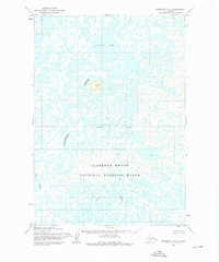
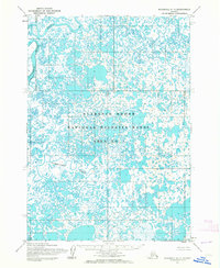
1953 Map of Marshall B-7
USGS Topo · Published 1976About this map
The Clarence Rhode National Wildlife Range covers the southern half of this landscape, reflecting early 1950s conservation efforts in the Yukon-Kuskokwim Delta region. The terrain is characterized by a dense network of water bodies and marshland, dominated by the sprawling Nuskealik Lake and the meandering paths of the Manokinak River, Kuyungsik River, and Talik River. One of the few significant relief features in this otherwise aquatic environment is Iwaktok Hill, standing as a solitary landmark amidst the wetlands. Photogrammetric methods from 1951 and 1952 aerial surveys reveal a region defined by its hydrography rather than human infrastructure, as the sheet confirms there were no roads or trails in this area at the time of field annotation in 1953. This map documents the natural state of the Alaskan tundra before subsequent changes in administrative naming and management.
Find a feature on this map
7 named features on this map. Tap any name to fly to it.
Don’t see what you’re looking for? This feature index may not catch every label — zoom into the map to look around manually.
Map Details
Editions of this 1953 Marshall B-7 Map
2 editions found
Other maps of this area

1951 · Marshall
USGS Topo · 1:250,000

1952 · Marshall C-7
USGS Topo · 1:63,360

1952 · Marshall C-6
USGS Topo · 1:63,360
1952 · Marshall C-8
USGS Topo · 1:63,360
1953 · Marshall B-8
USGS Topo · 1:63,360

1953 · Marshall B-6
USGS Topo · 1:63,360

1953 · Marshall B-7
USGS Topo · 1:63,360
1954 · Marshall A-8
USGS Topo · 1:63,360

1954 · Marshall A-6
USGS Topo · 1:63,360
1954 · Marshall A-7
USGS Topo · 1:63,360