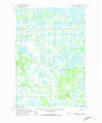
1952 Map of Marshall D-5
USGS Topo · Published 1973About this map
The Nantok River and Kashunuk River meander through a labyrinth of wetlands and water bodies in this remote Alaskan delta landscape. The mapping, based on 1951 aerial photography, documents a complex hydrological system where the Maninglik River joins the larger drainage networks. This area, largely defined by its intricate water patterns, shows minimal human development at the time of the survey, with the exception of the small settlement of Chakaktolik positioned near the confluence of the Kashunuk River and Chakaktolik Creek. The lack of roads or established trails on the sheet highlights the reliance on these river systems for navigation and access. It provides a technical record of the shifting delta environment before later 20th-century changes altered the hydrological profile of the Kusilvak region.
Find a feature on this map
5 named features on this map. Tap any name to fly to it.
Don’t see what you’re looking for? This feature index may not catch every label — zoom into the map to look around manually.
Map Details
Editions of this 1952 Marshall D-5 Map
3 editions found
Other maps of this area

1951 · Marshall
USGS Topo · 1:250,000

1952 · Kwiguk
USGS Topo · 1:250,000

1952 · Kwiguk A-4
USGS Topo · 1:63,360

1952 · Kwiguk A-3
USGS Topo · 1:63,360

1952 · Marshall D-5
USGS Topo · 1:63,360

1952 · Marshall D-4
USGS Topo · 1:63,360

1952 · Marshall C-6
USGS Topo · 1:63,360

1952 · Marshall C-5
USGS Topo · 1:63,360

1952 · Marshall D-6
USGS Topo · 1:63,360

1954 · Marshall C-4
USGS Topo · 1:63,360