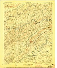
1900 Map of Maynardville
USGS Topo · Published 1907About this map
Tazewell and its neighbor New Tazewell anchor the northern reaches of this late-nineteenth-century survey, a region defined by the parallel ridges of the Appalachian Valley. The landscape is a network of small, family-centric settlements such as Sharps Chapel, Speedwell, and Lone Mountain, many connected by historic routes like Bunches Trace. The Powell River and Clinch River wind through the terrain, bridged only by numerous local crossings such as Black Fox Ford, Walkers Ford, and Needham Ford.
Find a feature on this map
185 named features on this map. Tap any name to fly to it.
Don’t see what you’re looking for? This feature index may not catch every label — zoom into the map to look around manually.
Map Details
Editions of this 1900 Maynardville Map
4 editions found

Other maps of this area

1883 · Morristown
USGS Topo · 1:125,000

1886 · Knoxville
USGS Topo · 1:125,000

1886 · Cumberland Gap
USGS Topo · 1:125,000

1887 · Jonesville
USGS Topo · 1:125,000

1888 · Cumberland Gap
USGS Topo · 1:125,000

1890 · Williamsburg
USGS Topo · 1:125,000

1891 · Cumberland Gap
USGS Topo · 1:125,000

1891 · Jonesville
USGS Topo · 1:125,000

1892 · Knoxville
USGS Topo · 1:125,000

1893 · Mt Guyot
USGS Topo · 1:125,000