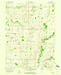
1959 Map of Mays
USGS Topo · Published 1960About this map
Mays anchors the northern portion of this Rush County landscape, where rural life in the late 1950s is defined by a dense network of watercourses and the infrastructure of the natural gas industry. The terrain is crisscrossed by several prominent waterways, including the Blue River, Flat Rock River, and Shankatank Creek, which shape the township boundaries of Center, Washington, Jackson, and Union. Evidence of local energy production is widespread, with numerous Gas Wells dotting the farmstead lots between small settlements like Occident and Sexton.
Find a feature on this map
28 named features on this map. Tap any name to fly to it.
Don’t see what you’re looking for? This feature index may not catch every label — zoom into the map to look around manually.
Map Details
Editions of this 1959 Mays Map
3 editions found
Other maps of this area

1948 · Lewisville
USGS Topo · 1:24,000

1950 · Dunreith
USGS Topo · 1:24,000

1950 · Lewisville
USGS Topo · 1:24,000

1953 · Cincinnati
USGS Topo · 1:250,000

1957 · Cincinnati
USGS Topo · 1:250,000

1959 · Rushville
USGS Topo · 1:24,000

1959 · New Salem
USGS Topo · 1:24,000

1959 · Mays
USGS Topo · 1:24,000

1959 · Falmouth
USGS Topo · 1:24,000
1960 · Manilla
USGS Topo · 1:24,000