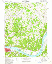
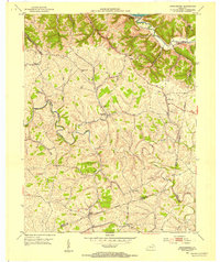
1961 Map of Maysville East
USGS Topo · Published 1963About this map
The Ohio River forms a wide, sweeping bend through this early 1960s survey, marking the state line between Ohio and Kentucky. In the southern portion of the map, the industrial and urban layout of Maysville is visible, featuring the Chesapeake and Ohio railroad corridor running parallel to the riverbank. This river-and-rail economy is contrasted by the high ridges and deep hollows of the Virginia Military District to the north, where small rural settlements like Beetle and Bradysville are linked by winding routes such as Bradysville Road and Scoffield Road. Genealogists will find a wealth of local landmarks, from Hiett Chapel and its associated Hiett Chapel Cem to the County Home and Ellis Grove Cem. The map captures a landscape defined by sharp elevation changes, where numerous streams like Threemile Creek and Lickskillet Branch have carved deep valleys into the surrounding plateau.
Find a feature on this map
66 named features on this map. Tap any name to fly to it.
Don’t see what you’re looking for? This feature index may not catch every label — zoom into the map to look around manually.
Map Details
Editions of this 1961 Maysville East Map
4 editions found
Other maps of this area

1915 · Maysville
USGS Topo · 1:62,500

1918 · Seaman
USGS Topo · 1:62,500

1919 · Maysville
USGS Topo · 1:62,500

1928 · Higginsport
USGS Topo · 1:48,000

1929 · Springdale
USGS Topo · 1:48,000

1931 · Higginsport
USGS Topo · 1:62,500

1935 · Springdale
USGS Topo · 1:62,500

1952 · Maysville East
USGS Topo · 1:24,000

1952 · Maysville West
USGS Topo · 1:24,000
1952 · Orangeburg
USGS Topo · 1:24,000