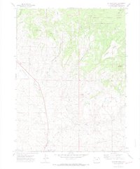
1971 Map of Mc Inturf Mesa
USGS Topo · Published 1974About this map
Mc Inturf Mesa and the surrounding high country of Routt National Forest characterize this landscape in northwestern Colorado. The terrain is marked by a complex network of water management features, including the Cataract Ditch, Elkhorn Ditch, and Tipton Ditch, which redirect snowmelt and streamflow from Falls Creek and Little Bear Creek. These irrigation systems signify the area's transition from wild mountain drainage to managed ranching and agricultural land in the early 1970s.
Find a feature on this map
23 named features on this map. Tap any name to fly to it.
Don’t see what you’re looking for? This feature index may not catch every label — zoom into the map to look around manually.
Map Details
Editions of this 1971 Mc Inturf Mesa Map
4 editions found
Other maps of this area

1916 · Craig
USGS Topo · 1:125,000

1923 · Elkhead Creek
USGS Topo · 1:62,500

1924 · Elkhead Creek
USGS Topo · 1:62,500

1954 · Craig
USGS Topo · 1:250,000

1957 · Craig
USGS Topo · 1:250,000

1958 · Craig
USGS Topo · 1:250,000

1960 · Craig
USGS Topo · 1:250,000

1962 · Craig
USGS Topo · 1:250,000

1964 · Craig
USGS Topo · 1:250,000

1965 · Craig
USGS Topo · 1:250,000