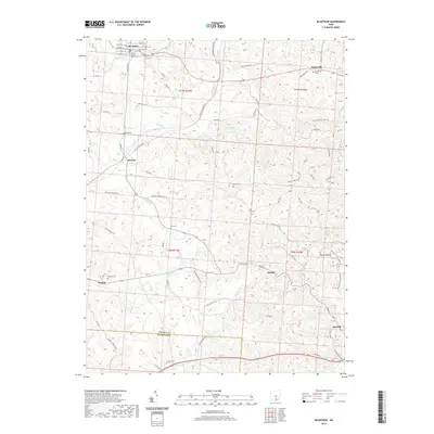
2019 Map of McArthur
USGS Topo · Published 2019About this map
The Vinton County Courthouse stands as the central landmark of McArthur, the county seat where a grid of streets like W Main St and S Market St converge near the Old McArthur Cem. This Vinton County landscape is defined by its series of hollows and runs, including Wolf Run, Sugar Run, and the winding Puncheon Fork. Small settlements such as Dundas, Puritan, Oreton, and Radcliff are distributed throughout the southern and eastern portions of the map, often situated near these watercourses. Genealogists will find a significant number of burial sites, from Prattsville Cem in the northeast to Lincoln Cem near the southern border. The eastern terrain is particularly notable for landmarks like Arch Rock and the Vinton Furnace side trail, which reflect the region's industrial and natural heritage near the Pierce Hollow drainage.
Find a feature on this map
75 named features on this map. Tap any name to fly to it.
Don’t see what you’re looking for? This feature index may not catch every label — zoom into the map to look around manually.
Map Details
Editions of this 2019 McArthur Map
This is the sole edition of this map. No revisions or reprints were ever made.
Other maps of this area

1904 · Zaleski
USGS Topo · 1:62,500

1905 · Wilkesville
USGS Topo · 1:62,500

1907 · Zaleski
USGS Topo · 1:62,500

1908 · Wilkesville
USGS Topo · 1:62,500

1910 · Laurelville
USGS Topo · 1:62,500

1912 · Laurelville
USGS Topo · 1:62,500

1913 · Jackson
USGS Topo · 1:62,500

1944 · Jackson
USGS Topo · 1:62,500

1944 · Laurelville
USGS Topo · 1:62,500

1947 · Columbus
USGS Topo · 1:250,000