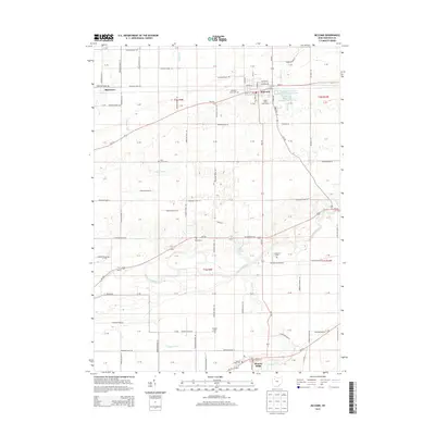
2013 Map of McComb
USGS Topo · Published 2013About this map
McComb and Benton Ridge anchor this Northwest Ohio landscape, where the flat agricultural terrain is defined by a rigorous grid of township roads and the meandering path of the Blanchard River. Small family and community burial sites, such as the Horn Family Cem and Knepper Cem, are scattered throughout the sections, offering significant data points for genealogical research in Hancock County. The northern portion of the map features substantial water management infrastructure, including McComb Upground Reservoir Number One and its counterpart, Number Two, situated near the Shady Acres Golf Course. Natural drainage like Pickens Run and Ottawa Cr contrasts with man-made improvements like Moffitt Ditch, illustrating how the local geography has been adapted for regional farming. The settlement of Shawtown sits at a crossroads in the northwest, further detailing the historical settlement pattern of this rural corridor.
Find a feature on this map
77 named features on this map. Tap any name to fly to it.
Don’t see what you’re looking for? This feature index may not catch every label — zoom into the map to look around manually.
Map Details
Editions of this 2013 McComb Map
This is the sole edition of this map. No revisions or reprints were ever made.
Other maps of this area

1903 · Findlay
USGS Topo · 1:62,500

1905 · Arlington
USGS Topo · 1:62,500

1907 · Bluffton
USGS Topo · 1:62,500

1907 · Arlington
USGS Topo · 1:24,000

1950 · Marion
USGS Topo · 1:250,000

1956 · Toledo
USGS Topo · 1:250,000

1960 · Deshler
USGS Topo · 1:24,000

1960 · Bluffton
USGS Topo · 1:24,000

1960 · Rawson
USGS Topo · 1:24,000

1960 · North Baltimore
USGS Topo · 1:24,000