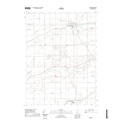
2019 Map of McComb
USGS Topo · Published 2019About this map
The village of McComb serves as the focal point of this Hancock County landscape, where the grid-like organization of rural roads meets the winding path of the Blanchard River. The topography is defined by the agricultural drainage systems common to northwestern Ohio, including the engineered Moffitt Ditch and natural watercourses like Needles Cr and Pickens Run. A distinctive industrial and municipal feature, the McComb Upground Reservoir Number One, sits just east of the village center, reflecting modern water management practices. For those researching local lineages, the map is punctuated by several small burial grounds, including the Horn Family Cem, Dukes Cem, and Knepper Cem, which dot the township sections between larger settlements like Benton Ridge and the hamlet of Shawtown. The map illustrates a well-connected rural economy tied together by a dense network of township and county roads.
Find a feature on this map
76 named features on this map. Tap any name to fly to it.
Don’t see what you’re looking for? This feature index may not catch every label — zoom into the map to look around manually.
Map Details
Editions of this 2019 McComb Map
This is the sole edition of this map. No revisions or reprints were ever made.
Other maps of this area

1903 · Findlay
USGS Topo · 1:62,500

1905 · Arlington
USGS Topo · 1:62,500

1907 · Bluffton
USGS Topo · 1:62,500

1907 · Arlington
USGS Topo · 1:24,000

1950 · Marion
USGS Topo · 1:250,000

1956 · Toledo
USGS Topo · 1:250,000

1960 · Deshler
USGS Topo · 1:24,000

1960 · Bluffton
USGS Topo · 1:24,000

1960 · Rawson
USGS Topo · 1:24,000

1960 · North Baltimore
USGS Topo · 1:24,000