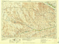
1958 Map of McCook
USGS Topo · Published 1958About this map
Republican River and Platte River valley landscapes define this mid-century survey, illustrating the critical role of water management in the High Plains. Large-scale irrigation and flood control projects are evident through features like Swanson Lake, Enders Reservoir, and the Medicine Creek Reservoir, alongside complex infrastructure such as the Tri-County Supply Canal and various siphons and flumes. The rail-dependent economy of the 1950s is anchored by the Chicago Burlington and Quincy and Union Pacific lines, which connect agricultural hubs like McCook, Imperial, and Gothenburg. Away from the river corridors, the expansive Sand Hills terrain is dotted with isolated settlements such as Brandon and Grainton, while a dismantled railroad segment near the northern border hints at shifting transportation patterns. Local landmarks, including St Johns Church and numerous grain elevators, provide specific points of interest for genealogical and regional history research.
Find a feature on this map
93 named features on this map. Tap any name to fly to it.
Don’t see what you’re looking for? This feature index may not catch every label — zoom into the map to look around manually.
Map Details
Editions of this 1958 McCook Map
2 editions found

Other maps of this area

1893 · Norton
USGS Topo · 1:125,000

1896 · Lexington
USGS Topo · 1:125,000

1896 · Arapahoe
USGS Topo · 1:125,000

1897 · Ogallala
USGS Topo · 1:125,000

1898 · Arapahoe
USGS Topo · 1:125,000

1898 · Paxton
USGS Topo · 1:125,000

1899 · Lexington
USGS Topo · 1:125,000

1899 · North Platte
USGS Topo · 1:125,000

1900 · Chappell
USGS Topo · 1:125,000

1900 · Ogallala
USGS Topo · 1:125,000