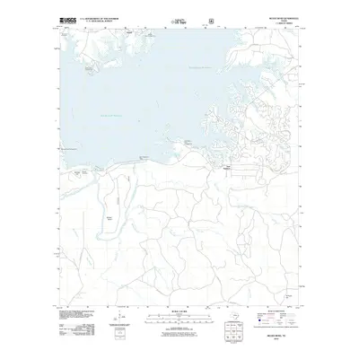
2010 Map of McGee Bend
USGS Topo · Published 2010About this map
Sam Rayburn Reservoir dominates this landscape, having significantly altered the geography of the Angelina River and its surrounding tributaries by the early 21st century. The map provides a detailed look at the infrastructure supporting this massive waterway, including the Sam Rayburn Dam and numerous recreational sites like Ebenezer Park Campground and Twin Dikes Park Campground. South of the reservoir, the terrain rises toward McGee Hill and Hi Truett Hill, where a network of rural roads and county routes connects the settlements of Sam Rayburn and Powell. For local historians and genealogists, the inclusion of Townsend Cemetery and McGee Cemetery offers specific points of interest for tracing family roots in this corner of San Augustine County. The intricate shoreline of Ayish Bayou and Little Tiger Creek highlights the complex intersection of the managed water system and the natural river bottom drainage.
Find a feature on this map
38 named features on this map. Tap any name to fly to it.
Don’t see what you’re looking for? This feature index may not catch every label — zoom into the map to look around manually.
Map Details
Editions of this 2010 McGee Bend Map
This is the sole edition of this map. No revisions or reprints were ever made.
Other maps of this area

1952 · Lake Charles
USGS Topo · 1:250,000

1953 · Alexandria
USGS Topo · 1:250,000

1953 · Palestine
USGS Topo · 1:250,000

1954 · Lake Charles
USGS Topo · 1:250,000

1954 · Beaumont
USGS Topo · 1:250,000

1955 · Alexandria
USGS Topo · 1:250,000

1955 · Roganville
USGS Topo · 1:62,500

1955 · Curtis
USGS Topo · 1:62,500

1957 · Beaumont
USGS Topo · 1:250,000

1957 · Palestine
USGS Topo · 1:250,000