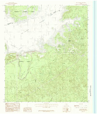
1984 Map of McGee Bend
USGS Topo · Published 1984About this map
Sam Rayburn Reservoir dominates the northwestern portion of this 1984 survey, its broad waters covering the lowlands along the Angelina River. The landscape is a mix of dense woodlands and emerging residential development, most notably at Rayburn Country near the reservoir's eastern shore. Much of the surrounding terrain is protected within the Angelina National Forest, where a network of tributary creeks including Alligator Creek, Beef Creek, and Hog Creek carve through the East Texas timberland.
Find a feature on this map
22 named features on this map. Tap any name to fly to it.
Don’t see what you’re looking for? This feature index may not catch every label — zoom into the map to look around manually.
Map Details
Editions of this 1984 McGee Bend Map
This is the sole edition of this map. No revisions or reprints were ever made.
Other maps of this area

1952 · Lake Charles
USGS Topo · 1:250,000

1953 · Alexandria
USGS Topo · 1:250,000

1953 · Palestine
USGS Topo · 1:250,000

1954 · Lake Charles
USGS Topo · 1:250,000

1954 · Beaumont
USGS Topo · 1:250,000

1955 · Alexandria
USGS Topo · 1:250,000

1955 · Roganville
USGS Topo · 1:62,500

1955 · Curtis
USGS Topo · 1:62,500

1957 · Beaumont
USGS Topo · 1:250,000

1957 · Palestine
USGS Topo · 1:250,000