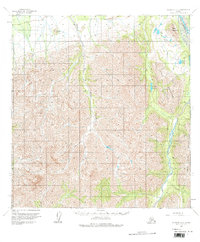
1958 Map of McGrath B-2
USGS Topo · Published 1984About this map
Farewell Airport serves as a lone outpost of connectivity in this mid-century survey of the Alaska interior. The landscape is defined by the significant elevation of the Terra Cotta Mountains and Tunis Mountain, where the drainages of Sheep Creek and Tin Creek carve deep through the terrain. To the east, the Post River flows toward its junction with the S Fk Kuskokwim R, creating a network of waterways that includes clustered alpine features like High Lakes and the isolated Veleska Lake. The presence of named summits such as Egypt Mountain and St Johns Hill provides clear landmarks for those navigating this roadless environment. This 1950s documentation captures the area before modern infrastructure, preserving the original hydrological and topographical relationships of the Yukon-Koyukuk region.
Find a feature on this map
13 named features on this map. Tap any name to fly to it.
Don’t see what you’re looking for? This feature index may not catch every label — zoom into the map to look around manually.
Map Details
Editions of this 1958 McGrath B-2 Map
3 editions found
Other maps of this area

1949 · McGrath
USGS Topo · 1:250,000

1950 · McGrath
USGS Topo · 1:250,000

1954 · McGrath C-3
USGS Topo · 1:63,360

1958 · McGrath B-1
USGS Topo · 1:63,360

1958 · McGrath A-2
USGS Topo · 1:63,360

1958 · McGrath A-1
USGS Topo · 1:63,360

1958 · McGrath B-2
USGS Topo · 1:63,360

1958 · McGrath C-1
USGS Topo · 1:63,360

1958 · McGrath A-3
USGS Topo · 1:63,360

1958 · McGrath C-2
USGS Topo · 1:63,360