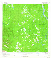
1954 Map of McGrath B-5
USGS Topo · Published 1964About this map
The Big River winds along the eastern boundary of this Interior Alaska landscape, serving as the primary drainage for a network of tributaries that carve through the Seward Meridian. Topography recorded in the early 1950s reveals a complex system of waterways, including the Selatna River and Tatlawiksuk River, which define the drainage patterns across this roadless expanse. Unlike many contemporary surveys, the land lines here were predetermined by the Bureau of Land Management rather than established by physical marking, reflecting the wilderness character of the region during the mid-twentieth century. The mapping, derived from aerial photographs, emphasizes the extensive swamp systems and low-relief areas that characterize the valleys between these prominent river systems.
Find a feature on this map
3 named features on this map. Tap any name to fly to it.
Don’t see what you’re looking for? This feature index may not catch every label — zoom into the map to look around manually.
Map Details
Editions of this 1954 McGrath B-5 Map
2 editions found
Other maps of this area

1949 · McGrath
USGS Topo · 1:250,000

1950 · McGrath
USGS Topo · 1:250,000

1953 · McGrath C-4
USGS Topo · 1:63,360

1954 · McGrath B-4
USGS Topo · 1:63,360

1954 · McGrath B-6
USGS Topo · 1:63,360

1954 · McGrath A-4
USGS Topo · 1:63,360

1954 · McGrath C-6
USGS Topo · 1:63,360

1954 · McGrath B-5
USGS Topo · 1:63,360
1954 · McGrath A-5
USGS Topo · 1:63,360
1954 · McGrath A-6
USGS Topo · 1:63,360