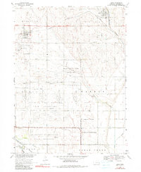
1969 Map of Mead
USGS Topo · Published 1991About this map
The University of Nebraska Field Laboratory dominates the central landscape of this Saunders County survey, occupying a substantial area of former military land south of Mead. The grid of the Nebraska National Guard Training Area and the U S Military Reservation indicate a strong post-war institutional and defense presence. In the north, the town of Yutan is situated near the confluence of local rail lines and Clear Creek, while Mead serves as a secondary focal point to the west. Transportation is defined by the competition between the Union Pacific and Burlington Northern railroads. Local genealogy is well-supported by numerous burial sites across the townships, including Morning Side Cem, St James Cem, Holst-Lawn Cem, and Parmenter Cem, which are scattered among the drainage basins of Silver Creek and Wahoo Creek.
Find a feature on this map
23 named features on this map. Tap any name to fly to it.
Don’t see what you’re looking for? This feature index may not catch every label — zoom into the map to look around manually.
Map Details
Editions of this 1969 Mead Map
4 editions found
Other maps of this area

1893 · Fremont
USGS Topo · 1:125,000

1896 · Fremont
USGS Topo · 1:125,000

1899 · Wahoo
USGS Topo · 1:125,000

1955 · Fremont
USGS Topo · 1:250,000

1957 · Fremont
USGS Topo · 1:250,000

1958 · Fremont
USGS Topo · 1:250,000

1968 · Valley
USGS Topo · 1:24,000
1968 · Ashland East
USGS Topo · 1:24,000

1968 · Leshara
USGS Topo · 1:24,000
1968 · Wann
USGS Topo · 1:24,000