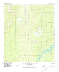
1958 Map of Medfra D-1
USGS Topo · Published 1988About this map
The Sischu Mountains dominate this 1958 interior Alaskan landscape, providing the high ground between the drainage basins of the Sethkokna River and the North Fork Kuskokwim River. Human presence is sparse in this subarctic wilderness, marked primarily by a lone Cabin and a lengthy Winter Trail that snakes through the western portion of the quadrangle. These seasonal routes were vital for movement across frozen muskeg and tundra before more permanent infrastructure reached the region.
Find a feature on this map
13 named features on this map. Tap any name to fly to it.
Don’t see what you’re looking for? This feature index may not catch every label — zoom into the map to look around manually.
Map Details
Editions of this 1958 Medfra D-1 Map
3 editions found

Other maps of this area

1948 · Kantishna River
USGS Topo · 1:250,000

1950 · Medfra
USGS Topo · 1:250,000

1951 · Kantishna River
USGS Topo · 1:250,000

1951 · Ruby
USGS Topo · 1:250,000

1952 · Mount McKinley
USGS Topo · 1:250,000

1952 · Ruby A-2
USGS Topo · 1:63,360

1952 · Ruby A-1
USGS Topo · 1:63,360

1952 · Kantishna River
USGS Topo · 1:250,000

1952 · Kantishna River A-6
USGS Topo · 1:63,360

1952 · Ruby
USGS Topo · 1:250,000