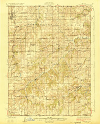
1924 Map of Melcher
USGS Topo · Published 1924About this map
Coal-mining hamlets and rural schoolhouses define this southern Iowa landscape during the mid-1920s, a period when the extraction industry shaped the growth of small company towns. Settlements like Bucknell, Tipperary, and Olmitz appear as concentrated hubs of activity alongside the Rock Island and Pacific RR, which facilitated the transport of coal from operations such as Mine No 4 and Mine No 18. The terrain is deeply etched by a network of waterways including Whitebreast Creek and the aptly named Coal Glen School, illustrating the close relationship between the local geography and the industrial economy of the era.
Find a feature on this map
81 named features on this map. Tap any name to fly to it.
Don’t see what you’re looking for? This feature index may not catch every label — zoom into the map to look around manually.
Map Details
Editions of this 1924 Melcher Map
3 editions found
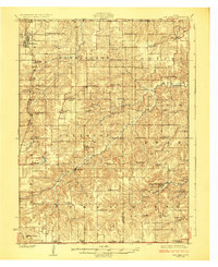
Other maps of this area

1909 · Knoxville
USGS Topo · 1:62,500

1910 · Milo
USGS Topo · 1:62,500

1910 · Pella
USGS Topo · 1:62,500

1912 · Knoxville
USGS Topo · 1:62,500

1912 · Pella
USGS Topo · 1:62,500

1918 · Chariton
USGS Topo · 1:62,500

1924 · Melcher
USGS Topo · 1:62,500

1929 · Albia
USGS Topo · 1:62,500

1934 · Humeston
USGS Topo · 1:48,000

1935 · Russell
USGS Topo · 1:62,500