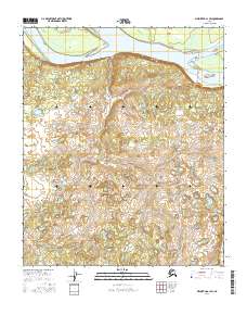
2016 Map of Melozitna A-1 SW
USGS Topo · Published 2016About this map
The Palisades rise prominently along the southern bank of the Yukon River, marking a dramatic geological transition in this remote Alaskan landscape. This 2016 survey, produced by the U.S. Geological Survey, details the braided river system where Weir Island and Cronin Island break the water's flow. To the east, the riverbank extends toward Clay Point, a distinct geographic marker at the bend of the water. The map reflects a territory primarily defined by its natural watercourses and high-relief terrain, with the townships of t4s r26e and t4s r27e transitioning into the more pond-scattered lowlands of the interior. The lack of modern road infrastructure underscores the river's historical role as the primary artery for movement through the Yukon-Koyukuk region.
Find a feature on this map
12 named features on this map. Tap any name to fly to it.
Don’t see what you’re looking for? This feature index may not catch every label — zoom into the map to look around manually.
Map Details
Editions of this 2016 Melozitna A-1 SW Map
This is the sole edition of this map. No revisions or reprints were ever made.
Other maps of this area

1951 · Ruby
USGS Topo · 1:250,000

1951 · Melozitna
USGS Topo · 1:250,000

1952 · Melozitna A-2
USGS Topo · 1:63,360

1952 · Ruby D-1
USGS Topo · 1:63,360

1952 · Ruby D-2
USGS Topo · 1:63,360

1952 · Ruby
USGS Topo · 1:250,000

1952 · Melozitna A-1
USGS Topo · 1:63,360

1953 · Melozitna A-2
USGS Topo · 1:63,360

1956 · Melozitna
USGS Topo · 1:250,000

1964 · Ruby
USGS Topo · 1:250,000